 The Chapter’s guest speaker for the August member’s meeting was Chris Lowie. Chris is the Great Dismal Swamp (GDS) Refuge Manager and has previously spoken to our chapter. His presentation on Wednesday night was on water management at the Great Dismal Swamp.
Chris started out with an overview of the GDS as a forested peat land. Peat lands are areas of land with a naturally accumulated layer of dead plant material (peat) formed under water-logged conditions. He explained how water moves through Pocosins, which is the name of the peat lands in this region.
Water is always moving through the peat and is only stagnant during dry periods. Although the peat is as much as twelve feet deep in the GDS, water primarily moves through the top one to two feet of peat, referred to as the fibric layer. Because the peat layer is relatively thin, it becomes saturated quickly during the rainy season. Once all of the spaces between the peat particles fill with water, the water table rises above the ground surface. This is the point when water will flow across the peat surface, between the trees, towards the rivers. Flow from the top of the peat dome, towards the rivers is controlled by the conductivity of the upper peat and the steepness of the peat surface. As long as the amount of rain infiltrating into the peat is the same as the amount of water flowing out of the peat dome, the peat will remain saturated. When rainfall decreases during the dry season, the water table drops as ground water continues to flow laterally towards the rivers. In a natural peat land without ditches, the rate of lateral drainage is slow enough that the water table doesn’t drop much during the dry season. But in drained peat lands, the rate of lateral drainage to the rivers is much faster.
The original purpose of the GDS National Wildlife Refuge (GDSNWR) was to preserve the unique and outstanding ecosystem as well as protect and perpetuate the diversity of the wildlife. The Refuge’s vision is to endeavor to restore the biological diversity of the swamp ecosystem through hydrological restoration and fire management. The GDSNWR consists of 112,000 acres as well as a 16,000 acre North Carolina State Park. The swamp has 50,000 acres of inflowing watersheds.
Ditching at the GDS for drainage, logging and navigation began in the 1800’s. Ditch networks became much more extensive beginning in the 1950’s with the advent of modern excavation equipment. There are 150 miles of ditches today. As ditches were dug, the excavated material was piled up to create access roads. The ditches actively drain the surrounding peat but roads can act as barriers to surface and ground water movement. The ditch network and the orientation relative to the natural topography dictates the extent of the drainage. The magnitude and complexity of the ditch networks is one of the challenges to hydrologic restoration at the refuge.
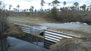
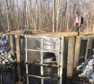
The refuge has established a comprehensive hydrology plan to maintain or restore hydrologic conditions to sustain or improve viability of wetland communities, as well as to maintain and operate structures to support flood control and fire management. The Hydrology Restoration Plan requires the addition of water management capabilities. The approach being taken is to install water control structures and culverts in ditches. This allows for raising ditch water levels which slows drainage from surrounding peat lands. There are currently 63 water control features in the refuge. Additional structures may be added as part of the on-going studies.
Chris’ presentation ended with a series of pictures and explanations of various water management structures and how they are used.
August 2017 Guest Speaker
Bookmark the permalink.


